Tokyo Stroll Supplement: Hahajima
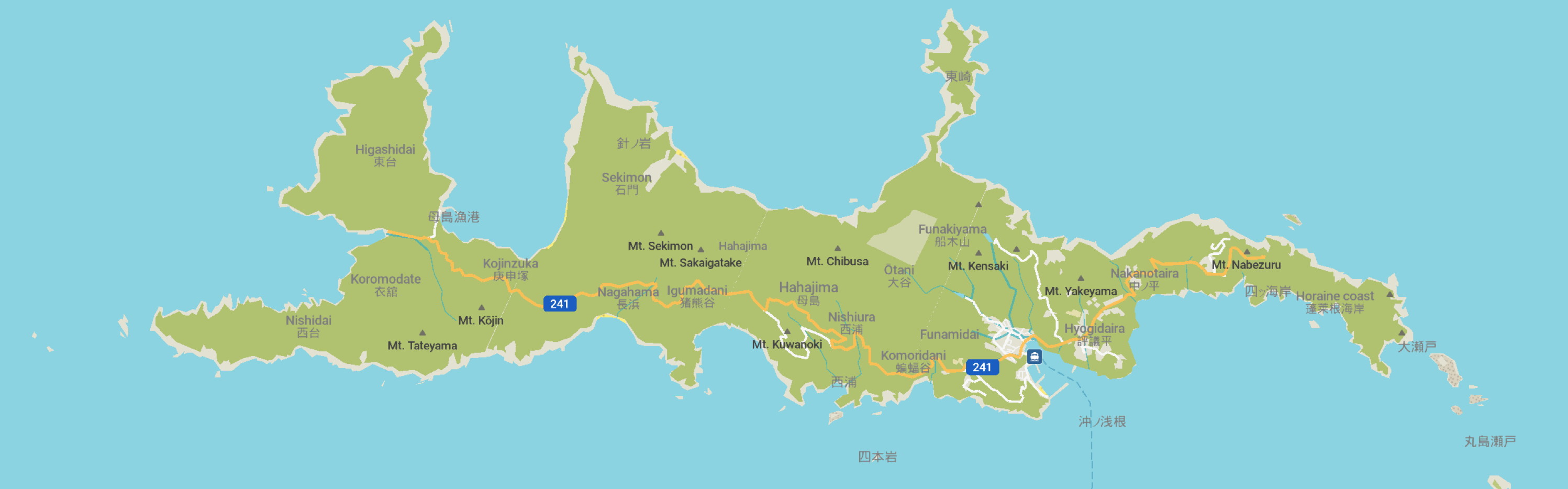
This page is for locations on the island of Hahajima in the village of Ogasawara Mura of the Ogasawara Subprefecture of Tokyo. This island is not part of my book Tokyo Stroll.
For information on Tokyo Stroll and this web supplement see Tokyo Stroll Supplement home page
For users of the Organic Maps, Maps.Me and Google Maps apps the items below have bookmarks you can import into those apps to make navigation easier.
Instructions and links are on the Viewing Locations in Organic Maps, Maps.Me, Google Maps, or Google Earth page.
Some entries on this page may include a note that says "Description to be added soon ." These entries are for items I felt should be listed even if the description is not ready to assist those who wish to plan a trip. When possible I included a link to an official web page, I suggest also doing web searchs for more information.
Hahajima (母島)
Official pages for each of the towns and villages of Tokyo will have sections of interest to visitors. These will likely be labeled as dealing with culture, tourism, or events.
Ogasawara Mura official site for Hahajima: https://en.vill.ogasawara.tokyo.jp/hahajima/
Hahajima Tourist Association: https://hahajima.com
NOTE: Given the difficulty of adding many specific location bookmarks to my bookmark files some places on the island may not be listed. Check the local website for more information.
ACCESS:
From Chichijima Island:
The Hahajima-maru Ferry runs once a day, going from Chichijima in the morning and returning in the afternoon. The trip takes about two hours.
HISTORY: Micronesian artifacts have been found on the island indicating visits, perhaps even some settlement. However the island remained uninhabited for a long time until settlers arrived from Hawaii to the Ogasawara Island chain in the early 19th century. During WWII the Japanese military evacuated all the civilian residents to Honshū. The island was bombed by the Americans in December 1944 followed by a landing of US Marines who took control of the island. To this day one of the tourist draws to the island is the remains of military fortifications.
The name of the island translates as "Mother Island."
ACTIVITIES: The island's economy is based on tourism, commercial fishing, a rum distillery, and a small bit of cocoa farming. For tourists dolphin watching, snorkeling, scuba diving, hiking, and seasonal whale watching are popular. For hiking you are required to have a certified guide to visit Mt. Sakaigatake and the Sekimon forest, such tours are only in Japanese. Bird watchers will be interested in that BirdLife International has declared the island an Important Bird Area.
POPULATION: The population in 2021 was 440.
DISTANCE FROM TOKYO: The island is located over 1,000 km south of Tokyo center in the Ogasawara Islands
ACCOMODATIONS: The island has several places to stay, reservations should be made in advance.
LOCAL TRANSIT: There's no public transport on the island, but you can easily explore it by foot, taxi, or rent a motorbike, car or bicycle.
Hōraine Coast / Hōraine kaigan (蓬莱根海岸)
Description to be added soon
Miyuki Beach / Miyukinohama (御幸之浜)
Description to be added soon
Ogasawara Hahajima Tourism Association / Ogasawara Hahajima kankō kyōkai (小笠原母島観光協会)
Description to be added soon
WEB:https://hahajima.com
Back to the Tokyo Stroll Supplement home page - Privacy Notice - Back to Gilles' home page
Created September 24, 2026 | Content last updated September 26, 2026